Alaska Photos
Page 1 | Page 2 | Page
3
Still to come: maps! This is the tale of the first voyage of the Davis's
Unwashed Crazy Kayakers (DUCK for short) Club. Long ago in a time known
as June of '97 four brave souls packed up and treked north to Alaska. They
traveled by plane, by van, by train, and by boat to reach Derickson Bay
where they were dropped off to begin their adventure. (is this writing
campy enough?) Derickson Bay is at the upper end of Nellie Juan Bay which
is part of Prince William Sound.
The weather didn't start getting rough, the tiny ship that took them
cut through the waves, and all arrived safely. This first page has pictures
from the first two days of the trip.
 |
 |
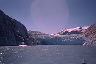 |
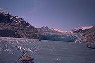
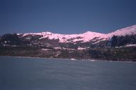
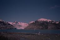
| This is Nellie Juan glacier. |
The glacier is about one third of a mile across at it's face and is
one of the glaciers fed by the Sargent Icefield. |
The water is cloudly because it has silt in it that the glacier picked
up as it traveled along. |
 |
 |
 |
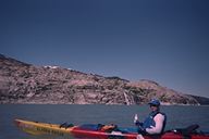
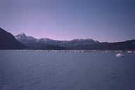
| This is David in one of the kayaks we rented. |
This view was taken from in front of the glacier looking back across
Derickson Bay. |
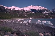
These pieces of ice were left on the beach when the tide went out.
The tides can vary by over 14 feet. Some of the icebergs in this picture
were 8 feet tall. |
 |
 |
 |
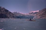
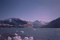
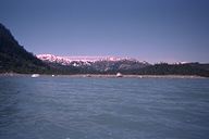
| This photo shows the glacier just to the right of the middle. It was
taken from about a mile and a half away. In the foreground you can see
more icebergs that were pushed across the bay by the winds that cool and
settle off the glacier. |
The ice from a glacier is made up of tightly compressed snow. It has
little air pockets in it that make popping noises as it melts. |
This picture shows the glacier too. |
 |
 |
 |
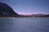
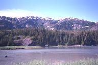
| The hill on the left is to the right of the glacier. |
|
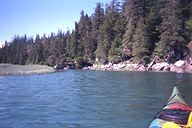
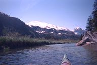
This is a river that goes from Derickson bay into a small freshwater
lake. The water here was much clearer than near the glacier. |
 |
 |
 |
| There were some deep spots in the river, but even 15 feet down the
bottom could still be seen clearly. |
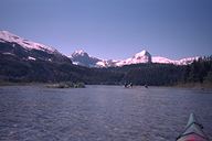
This is the lake we found further up the river. |
This is a picture taken at the lake |